




 From the Pamirs to the Aral Sea: Following the Amu Darya Through Central Asia
Support Novastan, the European Central Asia magazine
By supporting Novastan, you are supporting the only English, French and German-language media specialising in Central Asia. We’re independent and we need your help to stay that way!Thousands of kilometres before rusting fishing boats appear in the sands of Muynak, the Amu Darya begins as mountain water.
Its headwaters descend from the Pamirs and northern Hindu Kush through the Panj and Vakhsh river systems. The Panj marks much of the Afghan-Tajik border before meeting the Vakhsh; downstream of their confluence, the river takes the name Amu Darya.
From there, it leaves the mountains and enters an entirely different world of deserts, irrigated plains, ancient cities and modern international frontiers.
For centuries, the Amu Darya – the Oxus of antiquity – has helped determine where people could settle and where political power could flourish. Irrigation drawn from its waters sustained some of Central Asia’s great civilizations. Changes in its channels could nourish one settlement while depriving another of water. In the twentieth century, Soviet planners attempted to engineer the river on a vastly greater scale.
Read more on Novastan: The Caspian Sea Is Retreating. Central Asia Is Not Ready
Following it today from the mountains towards the Aral Sea means travelling through many of the defining questions facing contemporary Central Asia: hydropower and climate resilience, Afghanistan’s growing use of the river, cross-border trade, irrigation, agricultural dependence and the ecological legacy of the Aral disaster.
The river changes character repeatedly along the way.
In the mountains it is born. Along the Panj it becomes a frontier. On the Vakhsh it becomes electricity. At Termez it both divides and connects Uzbekistan and Afghanistan. In Khorezm it becomes the hidden infrastructure of civilization.
And near Muynak, its story ends in a landscape transformed by water that stopped arriving.
Before the Amu Darya: mountain water
There is no single spectacular spring at which the Amu Darya suddenly begins.
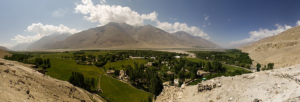
Its origins are dispersed across an immense mountain system. The Panj drains highland areas of Afghanistan and Tajikistan and forms a large part of their border. The Vakhsh descends through Tajikistan before joining it. From their confluence, the combined river flows westward as the Amu Darya.
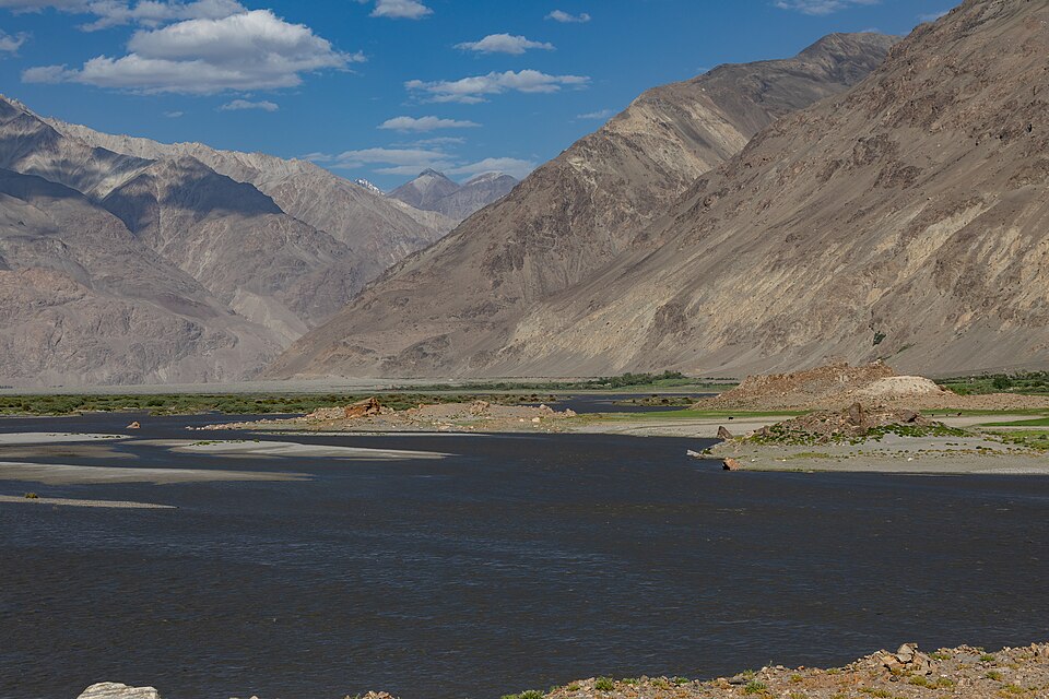
The landscape is almost the inverse of what waits downstream.
Steep valleys, snow and glaciated mountains ultimately feed a river that will later cross some of the driest inhabited territory in Eurasia. Water falling or freezing high in the mountains will eventually irrigate fields hundreds of kilometres away.
That physical connection is one reason climate and water management upstream matter so much farther downstream. The Aral basin itself ultimately depends heavily on river systems fed by mountain snow and glacial melt.
The Vakhsh: turning water into electricity
Before joining the Panj, the Vakhsh has acquired another role: energy.
Tajikistan has built much of its electricity system around hydropower, and the enormous Rogun project now under construction on the Vakhsh sits at the centre of that strategy.
In June 2026, the World Bank approved a further $300 million in financing for Rogun. Once fully operational, the plant is expected to generate around 14,400 gigawatt-hours of electricity annually – equivalent to roughly 60 percent of Tajikistan’s current electricity generation – while also allowing greater electricity exports to neighbouring countries.
This illustrates one of the recurring complexities of Central Asian water politics.
For Tajikistan, mountain rivers represent energy security, winter electricity and potential exports. Downstream, the same waters sustain irrigated agriculture.
These interests are not necessarily incompatible. Reservoirs can regulate flows as well as store water. But they mean that water cannot be understood simply in terms of quantity.
When it is stored and when it is released matter too.
Already, before the name Amu Darya even appears on the map, the river has become economic infrastructure.
Then the mountains recede.
Termez: Afghanistan across the water
At Termez, the geopolitics of the Amu Darya become tangible.
The river marks the boundary between Uzbekistan and Afghanistan. Beyond the Uzbek bank lies Balkh Province, while near the Friendship Bridge the Afghan border town of Hairatan forms one of Afghanistan’s principal gateways to Central Asia.
Here, Afghanistan is not an abstract subject of regional diplomacy.
It is physically across the water.
The Friendship Bridge carries road and railway connections across the Amu Darya. For decades it has accumulated political symbolism – Soviet troops crossed it during the withdrawal from Afghanistan – but today Uzbekistan increasingly wants Termez to represent something different: commerce, logistics and connectivity.
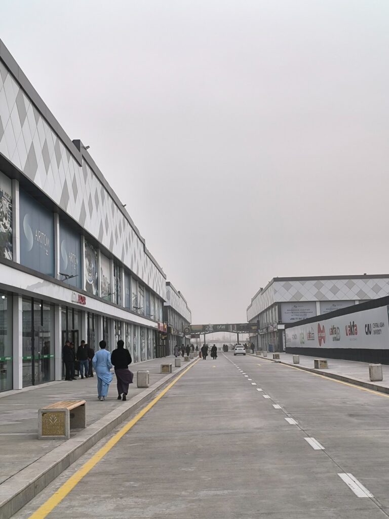
That shift is visible a short distance away at Airitom.
The Airitom Free Zone began operating in August 2024 near the Afghan border. It was explicitly created to promote international and cross-border trade and includes retail, logistics, hotel, medical and other facilities. Afghan citizens can enter the zone without an Uzbek visa for stays of up to 15 days.
The geography is striking: the zone sits beside the Amu Darya itself.
The same river that functions as a state boundary is therefore increasingly being treated as the edge of an economic corridor between Central and South Asia.
Afghanistan returns to the river
Trade is not the only way Afghanistan is reshaping the politics of the Amu Darya.
For most of the Soviet period, water allocation downstream was managed within a single political system. Afghanistan was never fully integrated into the institutional arrangements inherited by the Central Asian republics after 1991.
That asymmetry is now becoming much harder to ignore.
Afghanistan is constructing the 285-kilometre Qosh Tepa Canal across the country’s northern provinces, with the stated objective of bringing Amu Darya water to drought-prone agricultural areas.
From Afghanistan’s perspective, the argument is straightforward: the country has substantial agricultural needs and an interest in using a river flowing along its northern frontier after decades during which its ability to exploit those waters remained comparatively limited.
From downstream Uzbekistan and Turkmenistan, the same project looks different.
Every substantial withdrawal upstream potentially reduces what continues towards their irrigated regions. The project has therefore become one of the most consequential new questions in Central Asian water politics.
Yet portraying Qosh Tepa simply as an approaching “water war” would be misleading. The issue is better understood as the emergence of another major water user on an already intensely exploited river.
It reinforces the central fact of the Amu Darya basin:
Everyone has reasons to use more water.
Nobody can manufacture another river.
Turkmenabat: engineering the desert
Farther west, the Amu Darya enters Turkmenistan and passes Turkmenabat.
Here the relationship between water and human settlement becomes even more engineered.
Near the city, Amu Darya water enters the enormous Karakum Canal system, which carries it westwards through Turkmenistan.
The project embodied one of the defining ambitions of Soviet hydraulic planning: rather than accept the constraints imposed by aridity, engineers would move water across the desert.
And physically, they succeeded.
Water could sustain farms, settlements and industries hundreds of kilometres away from the river.
But the same logic was being applied across the basin. Irrigated agriculture expanded dramatically in Uzbekistan and Turkmenistan, while increasing quantities of water were removed before the Amu Darya reached its delta.
Yet large-scale irrigation itself was hardly a Soviet invention.
Downstream, communities had been redirecting the river for thousands of years.
Khorezm: a civilization built by canals
Few landscapes make that clearer than Khorezm.
Visitors arriving in Khiva encounter one of Central Asia’s most concentrated historic cityscapes: mud-brick walls, turquoise tiles, minarets and courtyards rising from an intensely arid environment.
What they do not encounter is the Amu Darya itself.
Khiva does not stand on the modern riverbank.
That apparent contradiction tells us almost everything about the historical relationship between Khorezm and water.
The city exists because the river was brought to it.
Khiva lies near the edge of cultivated land and historically received Amu Darya water through one of the major canals of the Khorezm oasis.
Long before modern states or Soviet hydraulic projects, inhabitants of Khorezm had learned to transform desert into an oasis through irrigation.
UNESCO’s documentation of the ancient towns and fortresses of the Aral Sea region dates irrigated agriculture in the lower Amu Darya to the end of the second millennium BC and directly links irrigation canals to the emergence of early cities in the region. Novastan has also explored the fortresses and historic landscapes of Khorezm, where the relationship between settlement and water remains visible across the region.
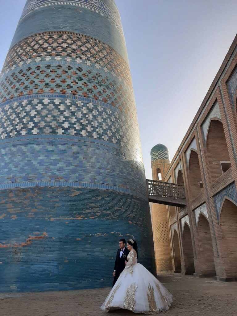
This history is not simply archaeological. The irrigation networks help explain why generations of people could live, farm, trade and build cities in an otherwise extremely arid landscape.
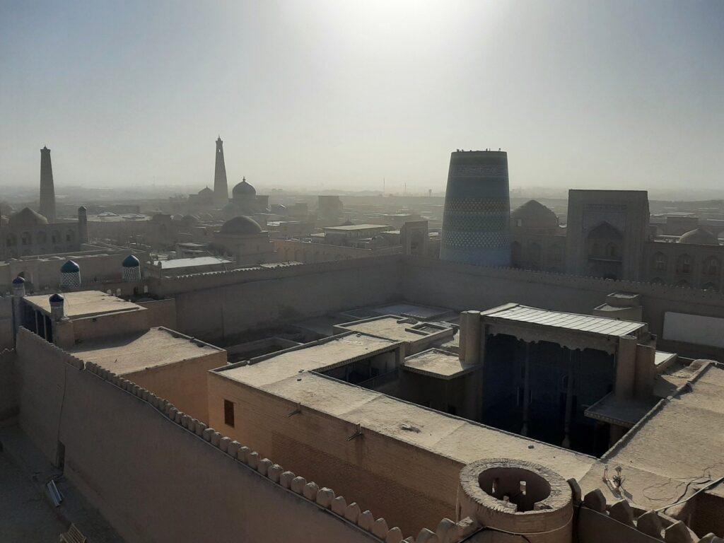
The lower river itself has never been completely stable.
Its channels shifted repeatedly. Canals silted up or were redirected. Settlements prospered and declined as their access to water changed. The Amu Darya still structures movement across Khorezm today, including crossings such as the pontoon bridge near Urgench previously featured by Novastan.
UNESCO’s documentation of ancient Khorezm explicitly notes that changes in the direction of the Amu Darya affected urban centres and that the region’s settlements were closely connected to the river’s shifting courses.
In Khorezm, controlling water meant controlling the geography of civilization itself.
Nukus: downstream of everyone
Approaching Nukus, the Amu Darya has travelled through an extraordinary accumulation of human interventions.
Upstream reservoirs regulate it.
Afghanistan is constructing new irrigation infrastructure from it.
Agricultural regions in Uzbekistan depend upon it.
Turkmenistan diverts part of it westwards.
By the time it reaches Karakalpakstan, the river represents the cumulative result of decisions made across an international basin.
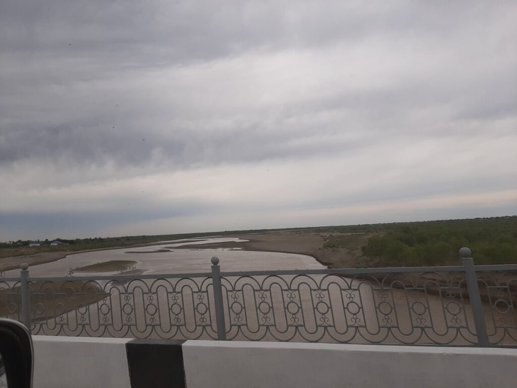
Near Nukus, the Amu Darya spreads through a broad, flat landscape, its channel interrupted by exposed banks and low islands. It looks very different from the mountain water with which the journey began.
Nukus is downstream not simply geographically, but politically.
Communities near the end of a river do not determine their water supply alone. They receive the cumulative result of decisions made everywhere upstream.
That reality remains highly contemporary.
In June 2026, Uzbekistan, UNDP and the Global Environment Facility signed the concept for an Integrated Water Resources Management Plan for the Lower Amu Darya Basin. The initiative is intended to create a more coordinated and science-based framework for managing water resources and ecosystems in the lower river and Aral Sea region.
It represents an attempt to think of the lower Amu Darya increasingly as a connected hydrological system rather than simply as water divided between administrative territories.
But the scale of the historical damage becomes clearer farther north.
Muynak: a port without a sea
At Muynak, one of Central Asia’s most familiar images has almost become too familiar.
Fishing boats sit in sand.
Visitors photograph their rusting hulls. What was once evidence of economic collapse has acquired the strange afterlife of a tourist attraction.
But the boats matter because of what is absent around them.
Water.
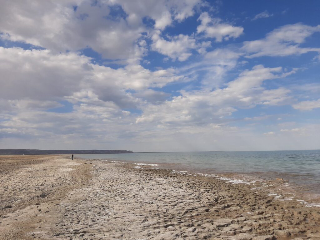
The Aral Sea was once the world’s fourth-largest inland lake. Its hydrological balance depended heavily on the Amu Darya and Syr Darya. Massive diversion of river water for irrigation caused inflows to collapse and the sea to shrink and fragment.
For Muynak this was not simply an environmental statistic.
It meant the disappearance of the economic geography around which the town had developed.
Fishing and fish processing depended upon a shoreline that progressively moved away. As Oktyabr Dospanov recalled in Novastan’s interview, “My Childhood Was Spent on the Shore of a Sea That No Longer Exists,” Muynak was once a living port rather than the symbol of ecological catastrophe it has since become.
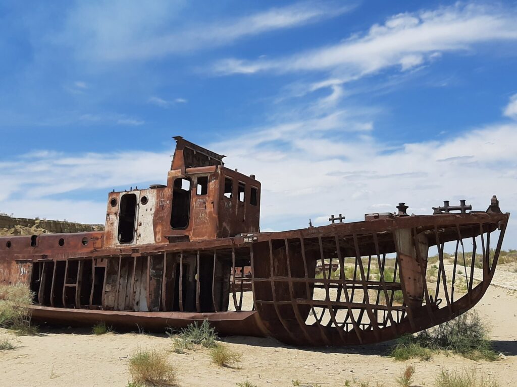
The rusting boats can be read almost as the final objects in a chain that begins in the mountains.
Reservoirs, canals, irrigation systems and agricultural decisions made hundreds or thousands of kilometres upstream all influence how much water ultimately reaches the lowest part of the basin.
The river’s history can almost be read backwards from Muynak.
The sea that did not entirely disappear
Popular descriptions often say simply that the Aral Sea “disappeared.”
The reality is more complicated.
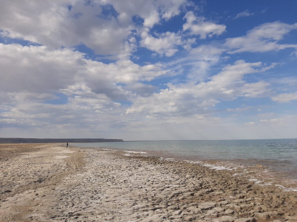
The sea fragmented into separate bodies of water. Large parts of its former seabed are now exposed, while significant differences have developed between the remaining northern and southern water bodies. The ecological catastrophe has been immense, but the Aral is not literally gone.
That distinction matters.
It prevents the region from being reduced to a single image of irreversible apocalypse. The northern Small Aral has, for example, demonstrated that deliberate water-management interventions can produce at least partial ecological recovery.
On the Uzbek side, however, the landscape around the southern remnants conveys the scale of what has been lost.
One river, competing futures
It would be easy to tell the history of the Amu Darya solely as a story of environmental destruction.
That would also be incomplete.
The river continues to sustain millions of people and several very different development strategies.
Tajikistan wants electricity.
Afghanistan wants irrigated farmland.
Uzbekistan needs water for agriculture while attempting to make irrigation more efficient.
Turkmenistan remains deeply dependent on water transported away from the river through its canal system.
Karakalpakstan needs sufficient flows to sustain communities and ecosystems at the end of the basin.
All of these demands are understandable.
The difficulty is that they exist simultaneously.
Qosh Tepa therefore matters not because competition for the Amu Darya is new, but because the political geography of that competition is changing.
Afghanistan is becoming a far more significant water user in a system whose post-Soviet institutions were largely built without it. Tajikistan’s hydropower development, downstream irrigation, ecological restoration and climate pressures meanwhile have to coexist within the same hydrological system.
There is no single technological solution that eliminates that basic constraint.
More efficient irrigation can help. Better canals can help. Improved regional coordination can help. Basin-level management can help.
But none can make the Amu Darya infinite.
From ice to sand – and water again
The extraordinary thing about following the Amu Darya is how many different worlds can belong to a single river.
In the mountains, its water begins among snow and glaciers.
Along the Panj, it separates Afghanistan and Tajikistan.
On the Vakhsh, it becomes electricity.
At Termez, the river forms Uzbekistan’s frontier with Afghanistan while Airitom attempts to turn that frontier into a commercial gateway.
In Khorezm, canals carried the river towards cities that could never have survived without it.
Near Nukus, the consequences of decisions taken across the basin accumulate.
At Muynak, ships remain stranded where water once stood.
And farther beyond them, parts of the Aral Sea remain.
Central Asia’s cities are usually explained through monuments, rulers and empires – the walls of Khiva, Buddhist Termez, Nukus’s museums.
Another history runs beneath all of them.
It is a history of glaciers, channels, dams and canals.
The Amu Darya has determined where settlement was possible, where agriculture could flourish and where political power could accumulate for thousands of years.
High in the mountains, water still begins its journey towards the plains.
At the other end of that journey, ships stand in the desert while a diminished sea survives beyond them.
Between those two landscapes lies much of Central Asia’s past – and one of the defining questions of its future.
By Mathieu Lemoine, Editor-in-Chief for Novastan-English.

Sophie Ibbotson, 2026-07-28
Wonderful to see this! It is the subject of my next book, Oxus: River to a Vanishing Sea, which will be published by Icon Books next year.
Reply