



 The Caspian Sea Is Retreating. Central Asia Is Not Ready
Support Novastan, the European Central Asia magazine
By supporting Novastan, you are supporting the only English, French and German-language media specialising in Central Asia. We’re independent and we need your help to stay that way!The world’s largest inland body of water is shrinking. From disappearing sturgeon and stranded ports to an unreliable trans-Caspian ferry and borders drawn around a moving shoreline, the consequences extend far beyond the environment.
For travellers hoping to cross the Caspian Sea between Kazakhstan and Azerbaijan, the journey has never resembled an ordinary international ferry connection.
Read more on Novastan: Hundreds of lifeless Caspian seals washed ashore in Turkmenistan
There is generally no dependable passenger timetable. The vessels are primarily designed to transport freight, railway wagons and vehicles, accepting individual passengers when operational conditions permit. Travellers may be told to wait in Aktau or Kuryk until sufficient cargo has accumulated, or to make their way to Alat, approximately 70 kilometres south of Baku, without knowing exactly when their ship will depart. Recent travel accounts continue to describe waits lasting several days.
This unreliability predates the current environmental crisis. It reflects freight-centred operations, poor passenger information and limited coordination between ports. But the difficulties now facing Caspian navigation are no longer only organisational.
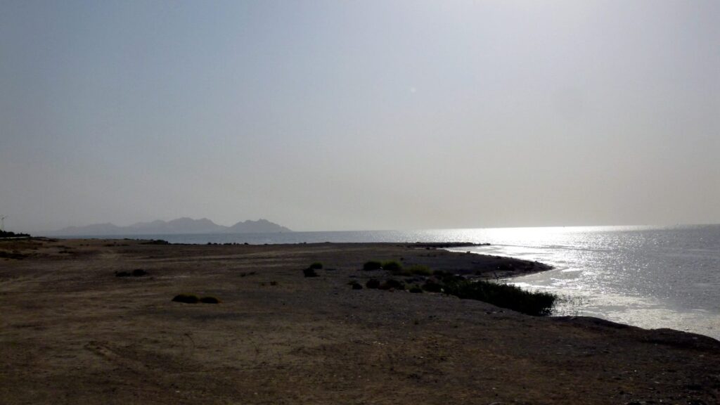
The water itself is retreating.
At Aktau and Kuryk, the Kazakh ports that connect Central Asia to Azerbaijan, the Caucasus and Europe, falling water levels are making navigation channels shallower and increasing the need for dredging – the removal of mud, sand and sediment from the seabed to maintain sufficient depth for ships. Vessels designed for deeper water may have to carry lighter loads. Infrastructure built for an earlier shoreline risks becoming progressively less effective.
The contrast is striking. Kazakhstan, Azerbaijan, the European Union and international financial institutions increasingly promote the Trans-Caspian International Transport Route, better known as the Middle Corridor, as a strategic bridge between Asia and Europe. Yet the sea at the centre of that corridor is becoming physically less navigable.
The Caspian has fluctuated throughout recorded history, rising and falling in response to changes in river flow, precipitation, temperature and evaporation. But since the mid-1990s, its level has followed a predominantly downward trajectory. Satellite-based research has estimated a decline of nearly seven centimetres annually between 1996 and 2015, accelerating to approximately ten centimetres annually between 2006 and 2021.
The eventual scale remains uncertain. Scientific projections differ according to future greenhouse-gas emissions, river inflows and the models used. But even a decline of five metres would transform the northern and eastern Caspian, where the water is exceptionally shallow. A fall of five to ten metres could critically disrupt ecosystems, remove most of the effective coverage of existing protected areas and leave billions of dollars of industrial and civil infrastructure obsolete.
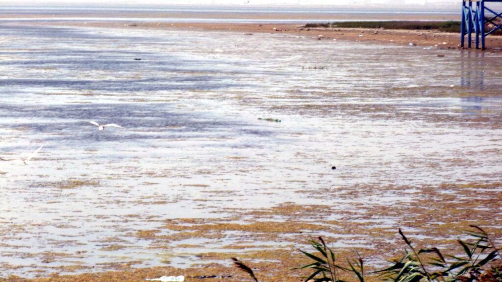
The Caspian is not about to disappear entirely. Its southern basin reaches depths of more than 1,000 metres. But a body of water does not need to vanish to cease performing the functions on which surrounding societies depend. Ports can become inaccessible. Wetlands and fishing grounds can disappear. Ships can lose carrying capacity. Settlements built around the coast can find themselves kilometres from the water.
For Central Asia, the retreating Caspian is becoming an environmental crisis, an economic constraint and a test of whether regional governments can cooperate before physical change overtakes political planning.
A sea dependent on distant rivers
The Caspian has no natural outlet to the ocean. Water enters through rivers and precipitation and leaves primarily through evaporation. Its level is therefore determined by the balance between inflow and water lost from its surface.
The system is also highly unequal. Although more than one hundred rivers flow into the Caspian, the Volga provides the overwhelming majority of its river water. The Ural, Kura and several smaller rivers supply much of the remainder.
This means that the fate of the Caspian is affected by decisions taken far from its shores. Reservoir management, hydropower, irrigation, industrial consumption and urban water use throughout the Volga basin can influence the quantity and timing of water reaching the sea.
It would nevertheless be misleading to attribute the present decline solely to dams or Russian water management. Rising temperatures increase evaporation from the Caspian’s vast surface, while changing precipitation and runoff affect its drainage basin. The water balance of a closed inland sea is especially sensitive to sustained warming.
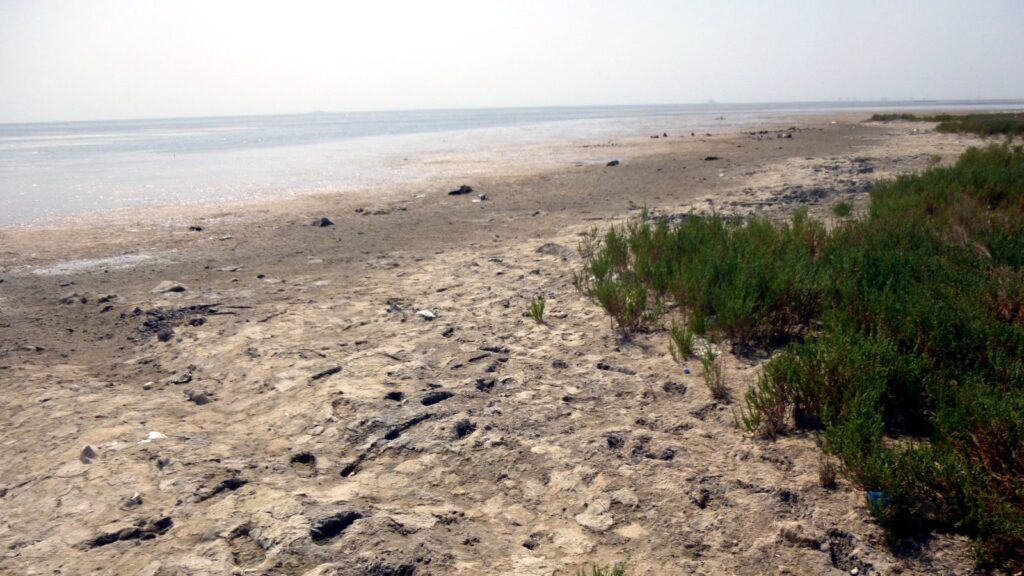
The northern basin is the most immediately exposed. Much of it is only a few metres deep, meaning that a relatively modest vertical fall can produce a dramatic horizontal retreat. In Kazakhstan, new stretches of exposed seabed are already emerging around the northeastern coast and the Ural River delta.
Read more on Novastan: Mer Caspienne : sommet décisif au Kazakhstan
These areas are not empty margins. They contain wetlands, bird habitats, fish nurseries and communities whose economic life developed around access to the water.
As the seabed dries, another problem may emerge. Salt, industrial contaminants and other pollutants accumulated in coastal sediments can be exposed to the wind. The experience of the Aral Sea has shown how a disappearing shoreline can become a source of dust carrying salt and toxic residues across large distances.
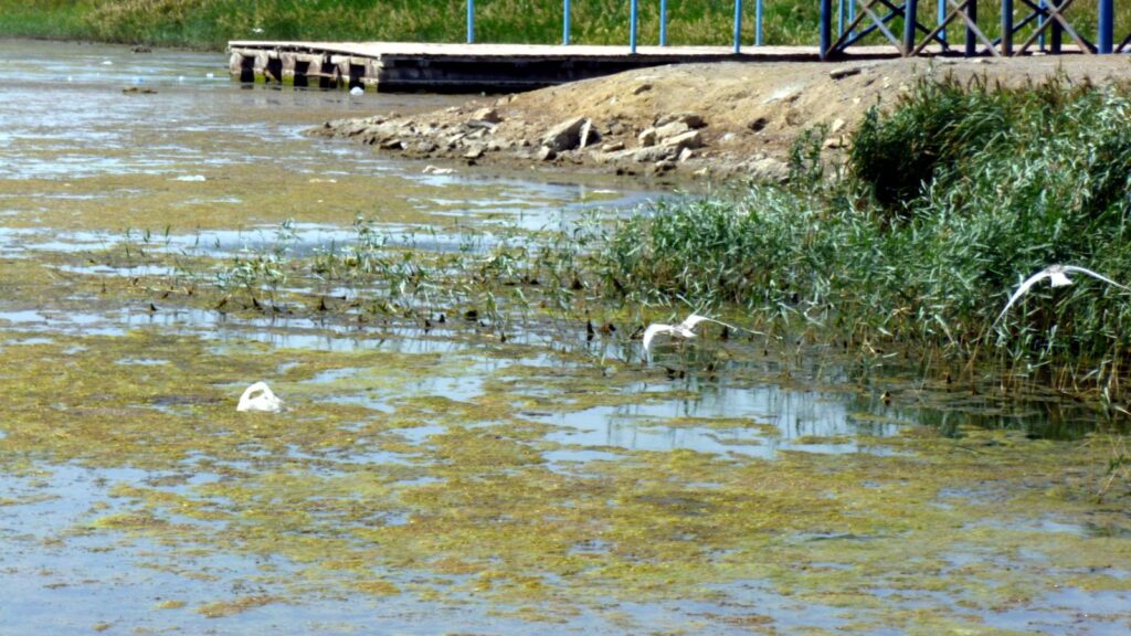
The comparison between the Aral and Caspian seas must be used carefully. The destruction of the Aral Sea was driven principally by the massive diversion of the Amu Darya and Syr Darya for irrigated agriculture. The Caspian is vastly larger, and climate-driven evaporation plays a much more significant role in its decline.
But the political lesson is relevant. Environmental catastrophe does not begin when the last water disappears. It begins when ecological and economic systems become unable to adapt to cumulative damage.
When the Soviet Union tried to close the Caspian’s “black throat”
The idea that the Caspian’s water level could be controlled through a decisive engineering intervention is not new.
On the Turkmen coast, a narrow strait connects the Caspian to Garabogazköl, also known by its Russian name, Kara-Bogaz-Gol. The vast, shallow lagoon is exceptionally saline. Caspian water flows into it and then evaporates, leaving behind concentrated salts and minerals.
During the Soviet period, planners came to see Garabogazköl as a leak through which the Caspian was losing valuable water. As the sea declined during the 1970s, the lagoon’s intense evaporation appeared to offer a straightforward explanation and an equally straightforward solution: close the channel.
A dam completed in 1980 blocked the connection between the Caspian and the lagoon. Without a continuous inflow, Garabogazköl rapidly contracted. By the middle of the decade, much of it had become an exposed salt basin. The ecological consequences extended beyond the lagoon itself, as winds carried salt from the dry surface across the surrounding territory.
Read more on Novastan: Agreement between Azerbaijan and Turkmenistan paves the way for Trans-Caspian Pipeline
In 1992, shortly after Turkmenistan became independent, the barrier was demolished and Caspian water was allowed to return.
The episode is more than an environmental curiosity. It shows the danger of approaching the Caspian as a hydraulic machine whose individual components can be blocked or redirected without wider consequences.
Closing Garabogazköl did not provide a durable solution to the Caspian’s fluctuations. Instead, it transferred the crisis from one body of water to another. By the time the lagoon was reconnected, the Caspian itself had begun rising again, illustrating how poorly its changing water balance had been understood.
The history matters today because falling levels may once again generate proposals for major engineering responses. Some ideas envisage regulating river flows, diverting water between basins or restricting the movement of water into highly evaporative areas. Others concentrate on dredging, artificial channels and the relocation of ports.
Some adaptation will be unavoidable. But Garabogazköl offers a warning against solutions that treat one symptom in isolation. The Caspian is an interconnected ecological system, not merely a reservoir to be managed for maximum economic utility.
The disappearance of the sturgeon
No species is more closely associated with the Caspian than the sturgeon.
For centuries, sturgeon fisheries supported communities around the sea and supplied the caviar trade for which the region became internationally famous. The fish migrate between the Caspian and its rivers, depending on access to spawning grounds in waterways such as the Volga and Ural.
Their decline began long before the present acceleration in falling water levels. Dams restricted access to spawning grounds, while pollution, overfishing and the illegal caviar trade placed enormous pressure on populations. After the collapse of the Soviet Union, the weakening of fisheries management and expansion of poaching further devastated stocks.
Official sturgeon landings across the Caspian fell from approximately 28,500 tonnes in 1985 to around 1,345 tonnes in 2005. More recent assessments describe Caspian sturgeon populations as being in critical condition.
Read more on Novastan: La mer Caspienne en état d’urgence
Hatcheries have released millions of young sturgeon in an attempt to compensate for the loss of natural reproduction. But stocking programmes cannot fully replace functioning rivers, wetlands and coastal habitats.
The shrinking sea adds another layer of pressure. The northern Caspian and its river deltas provide shallow feeding and nursery environments. As these areas retreat, salinity changes and habitats fragment, populations already damaged by decades of exploitation lose more of the conditions they need to recover.
The decline of the sturgeon therefore captures the cumulative character of the Caspian crisis. Climate change is not acting on an untouched ecosystem. It is amplifying damage created by dams, hydrocarbons, industrial pollution, illegal fishing and weak regional governance.
The loss is also cultural and economic. The sturgeon is not merely a biodiversity indicator. It represents a way of life that once connected fishing communities from Kazakhstan and Russia to Azerbaijan and Iran. Its disappearance would mark the collapse of one of the Caspian’s most distinctive shared traditions.
The Middle Corridor meets a shallower sea
The economic consequences of declining water levels are becoming particularly important as the Caspian assumes a larger place in Eurasian transport policy.
Russia’s full-scale invasion of Ukraine increased European and Asian interest in routes that avoid Russian territory. The Middle Corridor carries goods from China and Central Asia across Kazakhstan, the Caspian Sea, Azerbaijan, Georgia and Türkiye toward European markets.
Its maritime section depends primarily on the ports of Aktau and Kuryk in Kazakhstan and Baku’s port facilities at Alat in Azerbaijan. Turkmenbashi also has the potential to connect Turkmenistan and neighbouring countries to trans-Caspian trade.
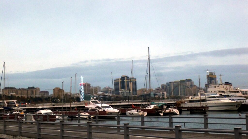
International assessments have warned that falling Caspian levels may require continued dredging, vessels with shallower draughts and improved navigation systems.
Read more on Novastan: By the Caspian Sea
These are not marginal technical adjustments. Ships unable to enter fully loaded carry less cargo at a higher unit cost. Repeated dredging requires sustained expenditure and can create further environmental disruption. Port infrastructure may have to be extended or relocated as the shoreline changes.
There is also a risk that investment decisions will be based on a static understanding of the sea. A terminal planned according to today’s water level may be poorly adapted to conditions two or three decades from now. Infrastructure with an expected operational life of fifty years must now be assessed against several possible Caspian futures.
The unreliable passenger connection between Kazakhstan and Azerbaijan exposes another weakness in official corridor narratives. For governments and financial institutions, the Caspian is often represented as a segment on a trade map: containers arrive at one port, cross the water and continue westward.
For travellers, the experience is far less seamless. The absence of a regular passenger timetable, uncertain departures and long waits demonstrate that the Caspian has not yet become an integrated regional transport space.
Falling water levels did not cause these organisational failures. But they can compound them by making navigation and port operations more expensive and less predictable.
If the Middle Corridor is intended to become a durable alternative between Europe and Asia, its planners must prepare not only for greater freight volumes but for the transformation of the sea itself.
Legal boundaries around a moving shoreline
For much of the period following the collapse of the Soviet Union, diplomatic arguments about the Caspian concentrated on whether it should legally be treated as a sea or a lake.
The distinction mattered because it could affect how the surface, seabed, fisheries and hydrocarbon resources were divided. Russia and Iran were joined after 1991 by three newly independent coastal states – Azerbaijan, Kazakhstan and Turkmenistan – each seeking access to offshore resources and control over maritime space.
The five countries eventually avoided choosing between the conventional categories. The Convention on the Legal Status of the Caspian Sea, signed in Aktau in 2018, created a special regime designed specifically for the basin.
It allows each state to establish territorial waters extending up to 15 nautical miles, followed by a ten-nautical-mile fishing zone. The remaining surface is intended for common use, while neighbouring states negotiate the division of sectors of the seabed. The Convention also excludes the military forces of non-Caspian states.
Read more on Novastan: Kazakhstan continues to assert itself as the “key link” in the Middle Corridor
The agreement was a major diplomatic achievement, but it was developed primarily around security, navigation, fisheries and hydrocarbons. It assumed that the sea’s basic physical geography would remain broadly recognisable.
A retreating shoreline complicates that assumption.
Territorial waters are measured from coastal baselines. As the water withdraws, islands may become connected to the mainland, bays may disappear and newly exposed land may alter the practical geography of coastal access. Fishing grounds and ecologically important habitats can shift away from the zones intended to regulate or protect them.
Existing bilateral seabed agreements are unlikely to be automatically overturned each time the shoreline moves. Yet practical questions will multiply. Who is responsible for newly exposed seabed? How should states manage wetlands that migrate across administrative or protected-area boundaries? What happens when navigation channels must be repeatedly dredged or moved?
The Convention has also not yet entered into force. As of the latest publicly confirmed position, Iran remained the only littoral state that had not completed ratification, with the issue expected to feature ahead of the Caspian summit planned in Tehran in August 2026.
The Caspian states spent more than two decades negotiating how to divide and use the sea. They are now confronting a different problem: how to apply those rules when the physical sea retreats from the lines drawn around it.
Cooperation without sufficient urgency
The main regional framework for environmental cooperation is the Tehran Convention, signed in 2003 by Azerbaijan, Iran, Kazakhstan, Russia and Turkmenistan.
At COP29 in Baku, representatives of the five states formally recognised the serious ecological, economic and social consequences of declining water levels. Work has since continued on a regional action plan, including meetings during 2025 and a high-level dialogue in Astana in April 2026.
This recognition is important, but it does not yet amount to a sufficiently ambitious adaptation strategy.
The region needs comparable hydrological data, shared climate scenarios and infrastructure planning based on different possible levels of decline. Coastal protected areas must be capable of moving with habitats rather than remaining fixed around today’s shoreline. Ports require coordinated investment, while fishing communities need support as traditional livelihoods become less viable.
The Volga’s importance makes Russian participation indispensable. Yet cooperation is constrained by sanctions, the war against Ukraine and distrust between the Caspian states. Governments also have competing interests in oil and gas production, transport corridors, fisheries and territorial control.
Environmental cooperation cannot avoid these political realities. Nor can engineering adaptation replace efforts to reduce pollution, protect river ecosystems and limit global warming.
The European Union also has a direct interest. It is promoting the Middle Corridor, closer economic links with Central Asia, renewable-energy connections and partnerships concerning critical raw materials.
Those policies cannot treat the Caspian merely as a neutral transport surface. European support for ports and logistics should incorporate long-term water-level projections, environmental monitoring and biodiversity protection. Otherwise, international institutions risk financing infrastructure built for a Caspian that no longer exists.
A sea does not have to disappear
The retreat of the Caspian is already visible, but its political consequences remain easier to postpone than its physical ones.
Governments can commission another study, organise another regional meeting or dredge another shipping channel. Each action may be useful. None resolves the fundamental mismatch between a rapidly changing environment and institutions designed around stability.
Garabogazköl demonstrated the danger of attempting to correct the Caspian through a single dramatic intervention. The collapse of sturgeon populations shows what happens when cumulative ecological damage is allowed to continue for decades. The Aktau-Alat ferry reveals how distant the region remains from the seamless connectivity presented in official strategies. The unfinished legal Convention illustrates how slowly political structures move compared with the shoreline.
The Caspian will not vanish like the Aral Sea. But its northern and eastern coasts could be transformed beyond recognition. Wetlands may disappear, ports may be stranded and communities may lose access to the water that shaped their economies and identities.
What remains uncertain is the eventual magnitude of the decline. Its direction is no longer seriously in doubt.
Central Asia already knows that a disappearing inland sea can be treated as an economic sacrifice until the damage becomes irreversible. The Caspian offers the region another warning – this time while there is still enough water, infrastructure and ecological life left to protect.
Mathieu Lemoine, Editor-in-Chief for Novastan-English